Imagining where the Green Line would be.
Up until now for my pedestrian observations I've been taking a walk some where, shooting some pictures, and typing up some of the things I've observed. In this case, I spent a day driving around Seattle taking a look at the locations for Monorail stations along the proposed Green Line.
I don't usually drive that much.. I had to take a lunch break at a park halfway through, and I was still so exhausted that I wasn't looking very closely by the end. Strange how I can walk five hours and be more alert than after three hours of driving.
At any rate, I started in West Seattle and worked my way to downtown. Then I drove all the way north and went from Ballard back to downtown again. By the time I reached Market I was tired and probably didn't notice many obvious problems through Interbay. Please drop me an email if you have any thoughts about any spots along the line.
Issues that apply to the whole line
An unfortunate consequence of running monorail down major roads is that they have been generally built for cars over the last half-century. Many have been more recently redesigned to provide safer pedestrian environments. However, several of the locations where stations will be placed need fine tuning to ensure safe approachs for riders.
almost all locations have multiple major bus lines intersecting with them. Metro may need to provide larger bus shelters. In the downtown core it will be important to provide wayfinding to Metro transfer points. The Metro lines themselves will probably have to be completely rethought - perhaps this is a way for Seattle to get much-needed extra service hours.
Thoughts on potential station signage
Riders may be disoriented after exiting the monorail (because they haven't been paying attention to direction), or may need better instructions than a route number to catch a bus headed in the correct direction to their destination. Metro bus stops in the immediate area of monorail station should be given unique identifiers such as the lettered bays at bus transit centers.
Similarly, stations and station exits should be given unique non-word identifiers. For example, number stations from the north to south. This will allow tourists who are unfamiliar with English or just Seattle topography to easily know which station to use (University Street vs. Univeristy District; Memorial Stadium vs. Safeco Field vs. Seahawks Stadium). The real benefit of a systematic station identification system will not be realized until multiple Monorail lines exist or the first Link line is completed.
Stations with more than one exit should have those exits designated with a systematic identifier as well to avoid confusion (3rd and Yesler vs. 3rd and James). For example, at station 11 (first stop on the first line), the exits might be 11A (west side of 15th) and 11B (east side of 15th). Giving instructions to tourists, customers, and guests will be much easier with predictable, uniform exits. Finding your exit on a map will be easier this way as well. When you are above or below street level, it is difficult to guess which exit is best for you. This is a significant issue in the north area of the Green Line, with large relatively hazardous intersections.
Placing station area maps near the station exit, with major pedestrian, bike, and bus routes highlighted is important. This would also be a good opportunity for advertising. Perhaps businesses could pay to have their store listed in a shopping mall-style color and number pattern (blue for restaurant, yellow for clothing retail, etc; listed by retail type in a key with street address).
Place route maps on the platform. Additionally, place signs on each side of the platform indicating which direction (an arrow, not "North" or "East") trains on that side will be headed, and what the name of the next station is. When a rider is on a mass-transit system, they do not think of the city in terms of north and south, or highways and freeways, or miles or blocks or neighborhoods. They think of it in terms of transit stops and transfers and they visualize distorted, not-to-scale system maps.
The Seattle bus tunnel fails to address many of these issues. It should be visited for perfectly incorrect examples of station signage.
The stops, from north to south
North Section, Ballard
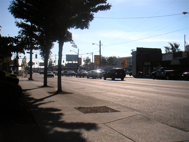
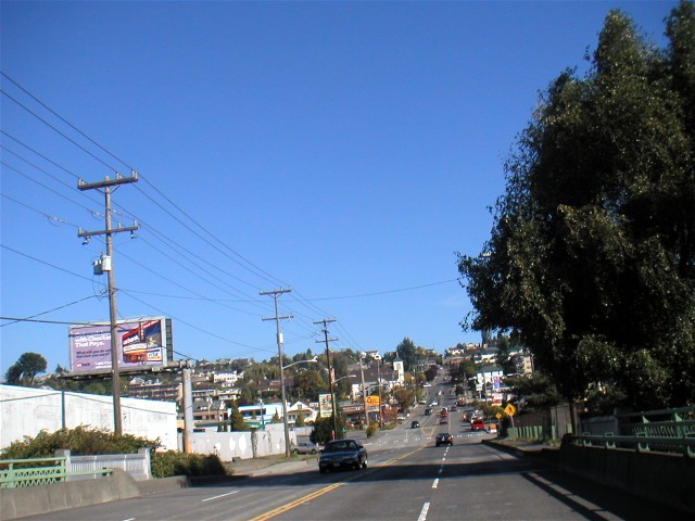
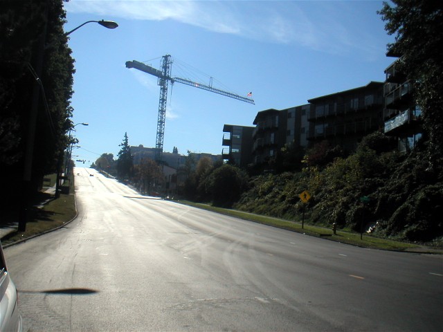
NW 85th and 15th NW:
No major destinations. Light retail which generally faces the sidewalk. Away from the two intersecting roads, the station area is predominantly small residential roads with traffic islands and single family homes. Metro routes 15, 48, and 75 will serve the station.
Both NW 85th and 15th NW are large roads. At the intersection, 15th is 7 lanes wide. Neither has good crossings for pedestrians except at major intersections. Riders leaving the station will need to get to the proper side of the street before heading towards their destination. Severe conflicts are likely with the large volumes of car traffic and increasing numbers of pedestrians. The station should attempt to provide as many above-grade crossings as possible. Perhaps a station straddling the intersection with eight stairwells could mitigate this?
On surrounding residential roads there are no sidewalks or curbs. It's difficult to tell if lawns enter the public right of way, or if owners are parking their cars on their lawns. Pedestrians probably favor the arterials for distance walking.
There's an awkward intersection between 15th and Holman, as the arterial turns. It could be a problem for pedestrians.
There will either need to be a park-and-ride lot at the ends of the Monorail, or useful feeder Metro lines in each compass direction.
South on 15th, looking at 85th.
Looking up 15th from the left turn lane of the arterial, which becomes Holman here.
NW 65th and 15th NW:
Ballard High School sits on one corner of this intersection. The surrounding area continues to be predominantly homes on small parcels. Light retail continues on 15th.
15th widens again to 7 lanes, but 65th is a small two-lane road. Same concerns as 85th.
South on 15th looking at 65th. Ballard High is on the left.
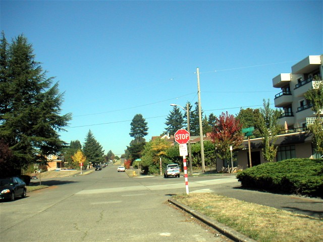
NW Market and 15th NW:
Market quickly turns into the Ballard core to the west, and pass by large retail to the east before heading up the hill to Wallingford and the U District. Ballard will be a major pedestrian destination, and this should be a major bus transfer point for UW/Wallingford/Fremont/Zoo/Locks.
15th seems to keep getting bigger; the lanes seem wider than at 85th, though the lane count is still at 7. Market is large as well, 5 lanes wide with space to turn right. Same concerns as 85th, but more pronounced because of the increased roadway size and likely increased station use.
East on Market looking at 15th
W Dravus and 15th W:
Light retail on 15th, residential in an hour-glass shape up hills to both sides. Users will need to climb steep hills to reach their homes; loop buses might be useful. Closest stop for Seattle Pacific University.
The sidewalk on the east side of 15th between Galer and Dravus is extremely small. Nothing sits between people and fast moving traffic, and the sidewalk is occassionally blocked.
W Galer and 15th W:
Probably few riders will walk away. Bikes or buses to Queen Anne and Magnolia. Eventually this could be a Waterfront Streetcar connection, and serve redevelopment of Port of Seattle property.
South on Elliot/15th at the Galer crossing
Further left at the Galer crossing
N Harrison and 1st N:
Major destination is the Seattle Center. No particular issues.
N Harrison and 5th N:
Ridership will be impacted by limited pedestrian connections to the South Lake Union area.
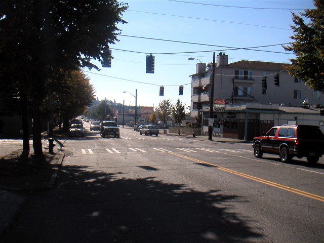
Denny and 5th:
Denny is not an inviting road to walk on.
Lenora and 5th:
No particular issues.
Pine and 2nd:
Pike Place Market, downtown retail. Buses to Capitol Hill. No particular issues.
Madison and 2nd:
Library, public buildings, financial district. Buses to First Hill, Seattle University, Madison Park. No particular issues.
Yesler and 2nd:
Public buildings, Pioneer Square. No particular issues.
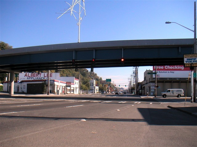
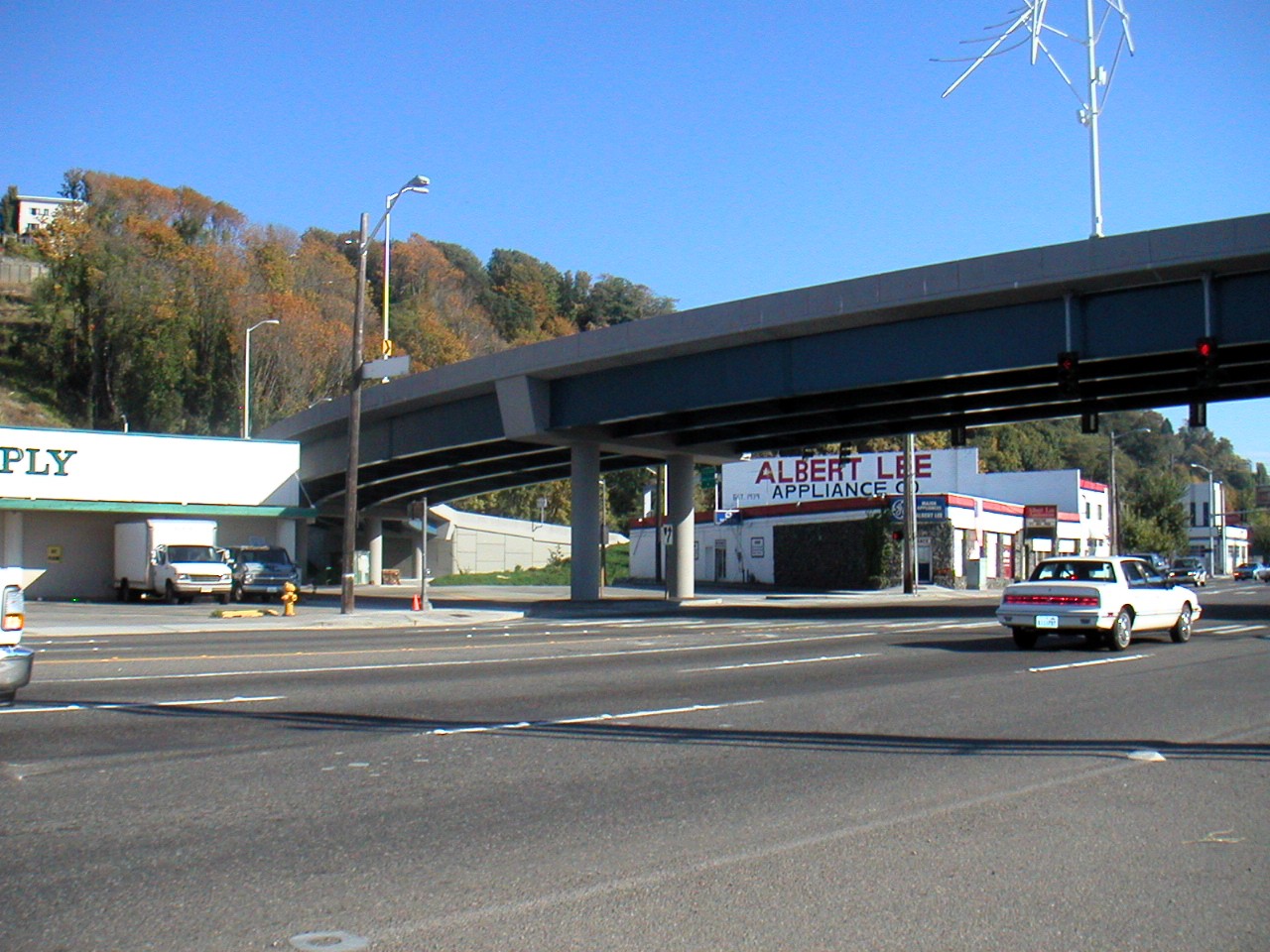
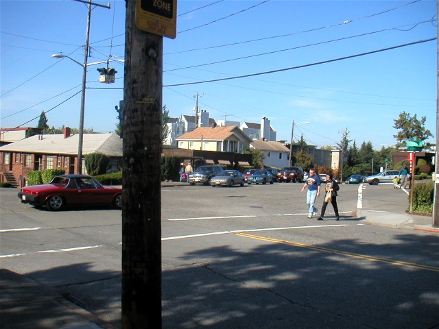
Jackson and 3rd:
International District, Pioneer Square, Sounder, Link, Metro, Sound Transit express buses.
The intersection at 4th and Jackson must be re-engineered. Transfers to the Link/Metro tunnel, as well as riders headed to the International District, will increase the pedestrian use of the south side of Jackson.
There is already a significant problem for cars wanting to get to I-5/I-90 from Jackson. For the left turn to southbound 4th, the space between signals is only large enough for a few vehicles. The angle of the intersection and length of the light causes these vehicles to endanger pedestrians moving through the crosswalk.
The difficulty of this turn encourages many drivers to turn down Maynard, 6th, or 5th into the International District. The movement on 4th needs to be favored in order to protect the large numbers of pedestrians in the ID.
Also, Metro buses making a right turn to northbound 4th frequently drop their poles from the overhead wires. This exacerbates traffic issues at this intersection and causes increased eratic behavior by drivers.
Buses beginning their run at Jackson through downtown and to outlying destinations are already impacted by Sounder trains. Mobs of Sounder riders swarm waiting buses at 4th and Jackson in order to get into downtown. This connection is much quicker for them than to travel into the bus tunnel. Travel time of the buses is only impacted slightly, perhaps a few minutes, and the impact on overall traffic of the pile up of boarding buses is light because of the early hour (7:15 and 7:45 AM). However, as King Street Station blossoms as a transit hub with all-day Link and Monorail transfers, travel time of these buses may be severely impacted.
Safeco Field:
Safeco Field, Metro busway.
Presumably there will be no issues after 4th S, Royal Brougham, and Atlantic are rebuilt.
This could be the Monorail's most grade-removed section, with possible unexpected negative impacts on views of Safeco field. The exact alignment of the Monorail is difficult to visualize without requiring pretzel-like windings around over and between raised roadways. Perhaps it will skirt along the edge of the I-90 4th S terminus. Then it will pass over the SR519 structures on Atlantic and Royal Brougham, and alongside the I-90 connection between those two roads. Maybe this will take it under the Safeco roof.
Placing landscaping below all of the raised freeways and guideways (I-90, I-5, SR519, Monorail) could turn this stop into a nice greenspace, increasing usage when games are not underway.
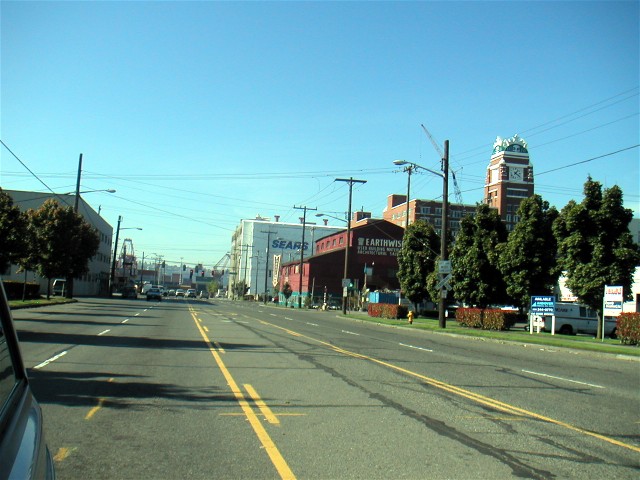
S Lander and 3rd S:
Metro busway, Link, Metro routes on 1st (five) and 4th (ten).
Perhaps Lander should be emphasized as a Metro and Link connection. Many West Seattle riders are sure to find this faster than continuing to King Street Station, so it might be effective to encourage that movement and take stress off of King Street. The walk to 4th or the Metro busway would take them within proximity of fast food chains.
It may be possible to integrate the Lander station with a Lander roadway grade separation over the BNSF railroad tracks. Abutting the tracks directly to the sidewalk could significantly lower the cost of this station.
Looking west at Starbucks and Sears on 1st from the railroad crossing between 1st and 4th on Lander
Delridge SW and West Seattle Bridge:
Closest stop to South Seattle Community College. Metro routes 20 and 135.
The most obvious issue in this area is the poor sidewalk on the east side of Delridge. It is narrow, and the steep slumping hillside seems to want to push walkers out into traffic. In one section, near a Metro shelter, a perilous sidewalk has been asphalted over the slump and is impassable by wheelchair. Cars are parked up on the sidewalk, and residential driveways and commercial parking lots are designed under the assumption that the sidewalk will be blocked.
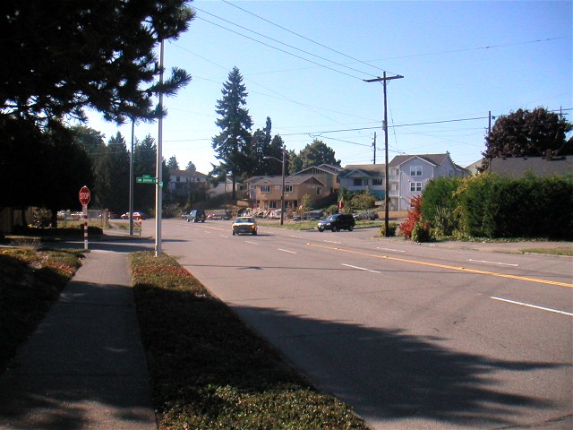
SW Avalon and 35th SW:
Metro route 21, 22, 51, 53, 54, 55, ST Express 570
The pedestrian environment is difficult to judge with 35th under reconstruction. Hopefully 35th will have bike lanes. There are several large intersections that don't appear to have much pedestrian traffic currently, so drivers will not be used to them to begin with.
Looking at the route map of Metro route 21, especially in agregate with the other numerous West Seattle routes, it's obvious Metro needs to put alot of thought into their service here. The routes could be cut in half, turning around at Avalon and 35th and heading back into West Seattle. The freed-up buses could serve other south-end needs along 1st S, ensuring that current 1st S riders wouldn't lose service.
Additionally, the Sound Transit Express route 570 makes little sense after the Monorail is built. Perhaps it should just loop from the airport to the ferry terminal and Morgan/California.
Looking up newly-asphalted 35th from Avalon
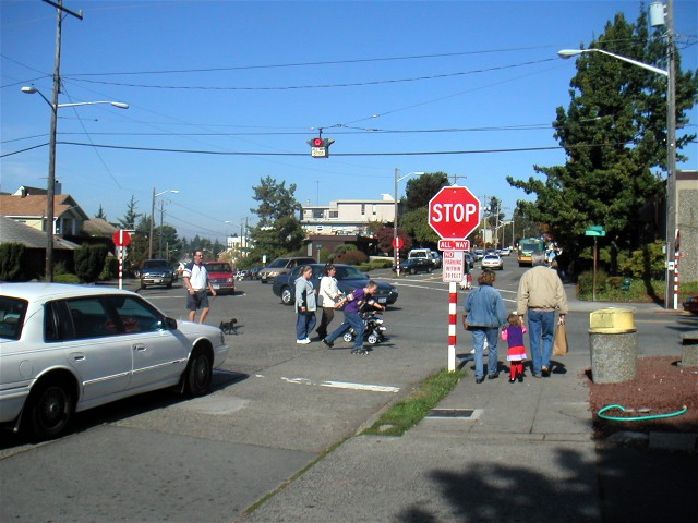
SW Alaska and 42nd SW:
West Seattle Junction, West Seattle Farmers Market, commercial district. Metro 22, 37, 51, 52, 53, 54, 57, 128, ST Express 570.
Two awkward intersections west of the station will need to have pedestrian improvements. First, the intersection of SW Glenn, SW Alaska, and 44th SW. Three walking movements do not have crosswalks currently. Second, SW Oregon, SW Glenn, and 45th SW. No walking movements have crosswalks. These intersections are awkward 5-way stops, extra wide for bus turns.
Looking north on 45th towards a bad intersection
Puppies being crossed on Alaska at 44th
Lots of people crossing 44th
In the distance a father struggles with two young children across the looong diagonal 2-lane crossing of 44th at Glenn/Alaska. He still has to contend with Alaska before they'll be at the West Seattle Farmer's Market.
California and Morgan:
No major destinations. Light retail abutting the sidewalk on California. Off of California, streets are small and lined with dense single family homes. Metro 22, 54, 116, 128, ST Express 570.
This is really an intersection with Fauntleroy; Morgan is a small residential street that splices into Fauntleroy halfway up the block. Fauntleroy is a foreboding street. Although only four lanes wide, it has wide lanes and almost enough space for parking. Residents are obviously leery of parking on it, though, as several blocks up from the intersection they all straddle the planting strip next to the sidewalk. There are no marked crosswalks on Fauntleroy except at major intersections. Riders exiting the Monorail need to somehow be guided to end up on the right side of it and not try crossing a few blocks up the street.
One concern for this area is that Fauntleroy is the only major road through it. With the monorail line terminating here, residents presumably will own cars in order to drive to southern or eastern destinations such as Westwood Town Center, South Seattle Community College, Sea-Tac, or even Burien. This could be avoided with good bus service from the Morgan station. For example, the 570 would need to be expanded to weekend service.
Standing on California looking south at Morgan
Standing on Fauntleroy looking southwest, about 5 blocks from California
