Have you walked around the International District in Seattle? No, I mean around it.
Sure, walking through and within the ID can be a harrowing experience. There are the stadium visitors searching for free parking, the herb and BBQ market customers double parking, the mid-block crossings, and the herds of restaurant-goers taking up the whole sidewalk.
But I'm talking about around the ID. Specifically, to the south. Civilization pretty much ends at Dearborn. The Duwamish Industrial Area leaders are okay with mixed use, but somehow it's not true for the area east of 4th, south of Dearborn. It's easy to mistake it for a buffer zone with hazards and filth to dissuade errant dog-walkers from getting too comfortable and keeping them away from heavier industry further south.
In this unattractive area is a cornucopia of pedestrian crosswalk signage. All it lacks are some of the bells and whistles (literally) of fancier buttons in other parts of downtown, or it would probably have the complete collectors' set of buttons, signs and signals. Have a look below to see what I'm talking about.
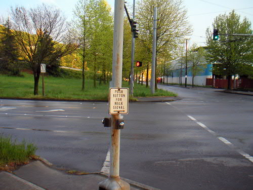
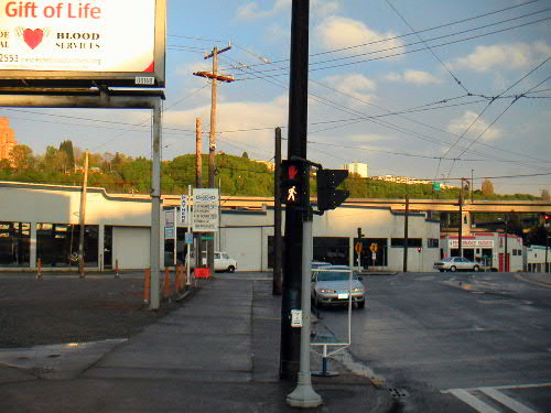
- At Royal Brougham and 8th South, this push button activates the signal towards which it points.
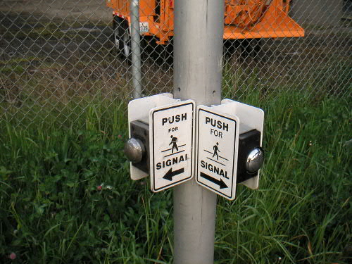
- A block west at Airport Way South, this push button activates laterally. Boy, that must be confusing for blind people.
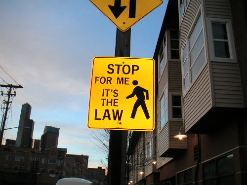
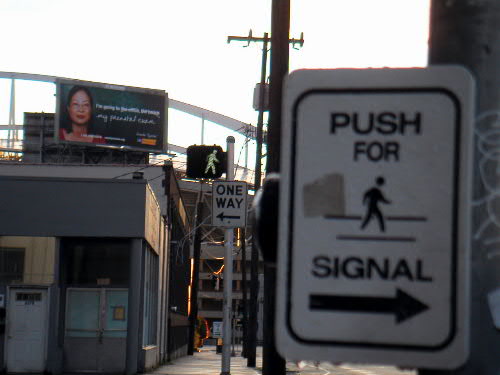
- At Dearborn and 6th South, this sign sends the right message.
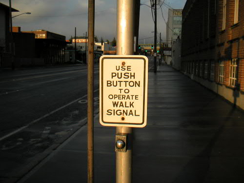
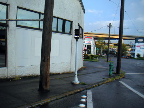
- Across the street, this well-meaning sign is incorrect. In fact, this signal is one of the few in the area that doesn't require a push to get a green walk signal.
- Dearborn and 6th South is interesting, because it has three different types of crosswalk signals, and even has a 'little people'-friendly button pole.
- You can also see the 'small man' signal at 6th South and Airport Way South.
- You can see the 'big man' at Dearborn and Maynard South. Did you notice that the button in the foreground points away from the direction of the signal it activates?
- You can see the 'small walk' at Maynard South and Airport Way South.
- And you can see the 'big walk' at Dearborn and 8th South
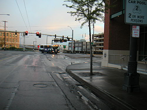
- At Dearborn and 5th South is my most feared crosswalk. The cameraman is standing in the middle of the right lane. Can you see my friend about to cross to the pedestrian island? Of course not, it's a blind corner: it's blocked by the new Opus building on the right, but perspective makes drivers think they have a clear view. Relieved to be done with their ID visit, they barrel around this final corner and can't see pedestrians about to cross with their back to the oncoming vehicles. I've seen a handful of near misses here. Who can blame the car drivers though? There's a big, confusing interection with strange angles. There are flashing neon traffic signs drawing their attention ahead, and maybe a dozen street signs intermixed with trees and parking meters on their right hand side as they approach.
- If you turn around and look across the street at Lane and 5th South, there's a similar yet opposite problem. Over here there are actually too many pedestrian signs. Look, two right next to each other. But only one crossing area is striped, and it's so faded I doubt anyone ever notices. In my opinion 5th Avenue South, which runs along Union Station and the ID Bus Tunnel Station, is a pedestrian death-trap waiting to close its jaws.
- The sidewalk is barely passable at Airport and 8th, with piles of leaves and bushes covering at least a foot of concrete
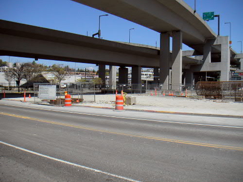
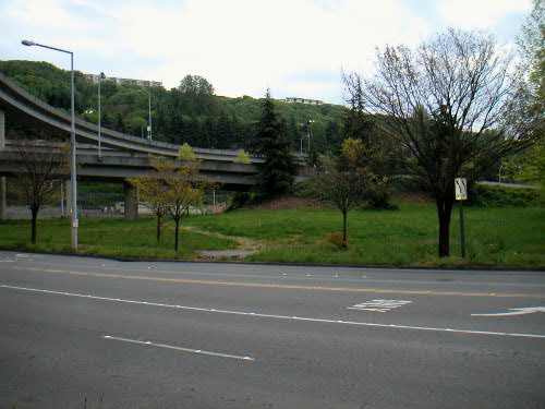
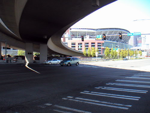
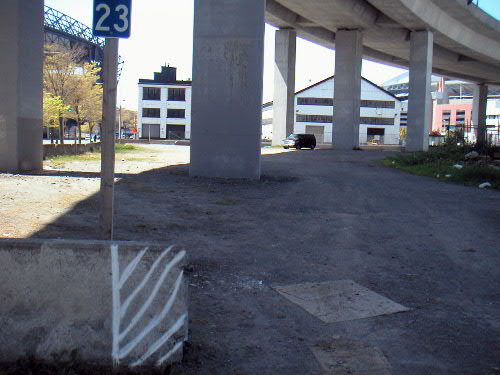
- Viaducts have the ID boxed in on three sides. I-5 is on the east. I-90 is on the south, including ramps to Airport Way and now ramps to Atlantic. To the west I-90 drops ramps to 4th and ramps to the bus tunnel and Dearborn. A seldom realized fact is that 4th Avenue, part of Jackson, and 2nd Extension are all viaducts as well, over train track right of way. Why do I care about offramps and viaducts? The space under the freeway structures is totally useless to the community. The exit at 4th has nice landscaping, but is inaccessible by pedestrians. Under 4th is used for construction staging. Under I-90 is used for vehicle storage and as a drop off for abandoned vehicles on the freeway. Under I-5 is a neighborhood parking lot and many fenced off slopes. Along I-90 on Dearborn is nice landscaping inaccessible by pedestrians. The Airport Way offramp is the only place with an useful grass-covered, accessible lot great for running dogs. Otherwise, all of the spaces easily reached from the ID are distasteful dirt covered lots only used by homeless people. What a great public investment!
