Various maps, serving widely different purposes, of neighborhoods in Tokyo.
The streets of Tokyo are rich with maps, among other things. This article focuses on depictions of neighborhoods, each created by an entirely different entity to depict a unique facet of their community. Later today I'll show maps of routes, and maps for emergencies.
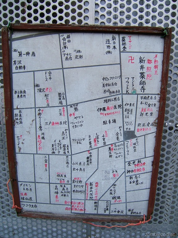 In Nakano, this map shows the locations of neighborhood businesses. It's hand written in red and black over a print out of the street network with major property lines. I find the use of red particularly interesting. It is used to write the type of business, for folks to easily find the what they're looking for. It's applied some what prejudicially, though, because not all businesses are included. An architect is, but not a construction tool shop. For a yakiniku restaurant, but not a yakitori restaurant. A convenience store, but not a cookware shop. Red is also used to make symbols stand out: a cross for a Christian church, a swastika for a buddhist temple, a postal symbol for a post office, and a "7" for a 7-11. Only two phone numbers appear on the map, both in red, for a dentist and an internal medicine doctor. A gynecologist has no number. The final message in red is in the bottom center, saying "Shin'i Yakushi Area Business and Industry Guide Map - Kanto Sign Design Company".
There's a great selection of maps like this - and the one below - at the site Scenes with Trains. The author, a model train fanatic, noticed these maps everywhere as he traveled the country taking train photos. He comments that there are nothing unique about them regionally, they only net $50 or so for the advertising agency, and he's yet to find one with useful information (to him).
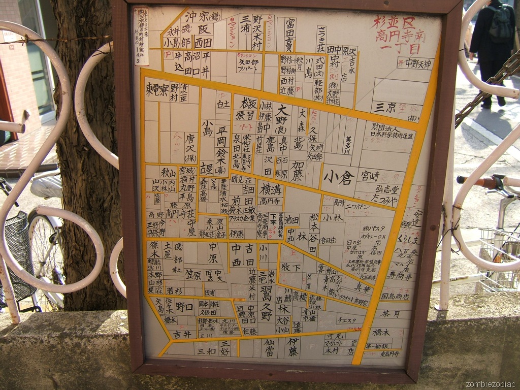 This map of southern Koenji shows businesses and major property owners. As with the above map, text is hand written in red and black, though the red has faded badly. Red is used for the gate symbol of a shrine, parking lots (P), condos and apartments (which are not named), and business types. Driveable (?) roads are marked in yellow, and red is use to indicate a staircase. Someone has written in a mobile phone number, apparently for a paint supply store.
One thing that jumps out at me is that there are a number of foreign names (written in katakana) for businesses along the wide north-south highway, Ome-kaido, but almost none elsewhere.
It's strange that the train buff above was so stymied by the prevalence of these maps throughout Japan. To me they're clearly direct descendents of Japanese maps made up until the early 1900s. Compare it to the map I included with my article about Fukuyoshi Rise, from 1858. No red is used on this map, but the streets are yellow. Shrines have a gate symbol next to them. Property "owners" are written along the street. Instead of アパート (apartment building) and マンション (condominium), it has クミ (communal home) and 小ヤシキ (shack).
A sticker in the top left indicates that this map was produced by 都市町村標識社 (To Shichouson Hyoushiki Sha, Capitol Municipalities Sign Company).
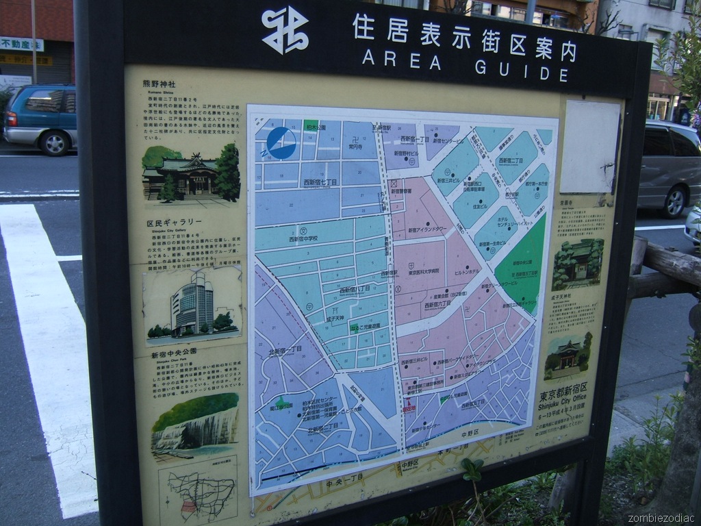 Here's a bureaucratic take on a community. It was made by one of the departments of the city of Shinjuku. Like an Edo era tourism map, there are major area sites pictured on either side, including Kumono Shrine, the Municipal Art Gallery, Shinjuku Central Park, Naruko Shrine, and Joen Temple. Oddly - maybe ominously? - one of the sites has been hidden by a blank sticker.
The map itself is colored to reflect postal address divisions. Text indicates the names of those address divisions as well as the locations of shrines, temples, skyscrapers, schools, hospitals and parks. Street names are also listed.
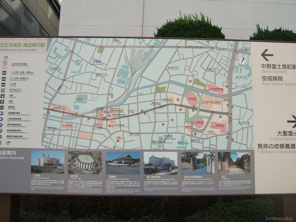 In southern Nakano, this streetside pedestrian map shows the building locations for the headquarters of the Japanese Christian church Rissho Kosei-kai. The major destinations are again imaged in the Edo tourist map style. Other than Rissho institutions, only a Salvation Army Hospital, two public schools and two subway stations are named.
A post office is pointed out with a symbol no one in Japan will recognize. And out of some sort of brotherly love, they've chosen to pinpoint the locations of neighboring Buddhist temples.
One of the oddest aspects of this map is the huge legend on the left. The map's colors and icons really need no explanation because they are very clear. The only information to be gained from the legend is the names of the parking lots. They also try to describe the two most used bus stops, but people must only be more confused by the odd reference system - just label the bus stops themselves! Without the legend, the map could have been enlarged, with totally empty areas at the south of the map removed.
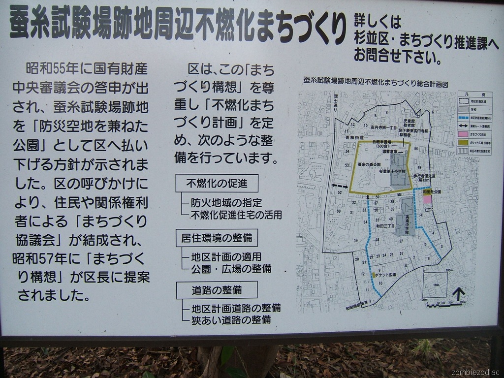 In southern Koenji, this map shows the community development (町づくり) activities of the city planning department. Really, it looks like an appeal to the local population that someone does care. A full half of the space is a textual description of planning board names and when they were formed. Finally they give the three categories of development: fire preparedness, livability, and street work.
Looking at the map, all I can see are numbers. They're the postal block numbers. Next is the blue dotted line, which are two roads that have been designated as sub-arterials, and will be widened to six meters. They ain't there yet. The green trapezoid hits me next, but the legend says it's a pocket park or plaza - huh? Searching the text on the map, I find an indicator that explains it's a pedestrian loop that has been created through the planning process.
The map is really a total failure. This group has done excellent work on their three goals within the project area, but it's tough to tell with this placard. The map does nothing to inspire new residents to get involved, or reassure old ones that their community is in good hands.
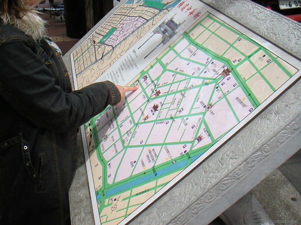 Okay, this isn't Tokyo. It's Yokohama's Chinatown. Close enough. This is very tasteful map, split in two parts. To the left is a broader area map showing how to get to the nearest train station. To the right is a map of the Chinatown gates (there are a dozen or so), as well as street names, public instituations, hotels, and parking.
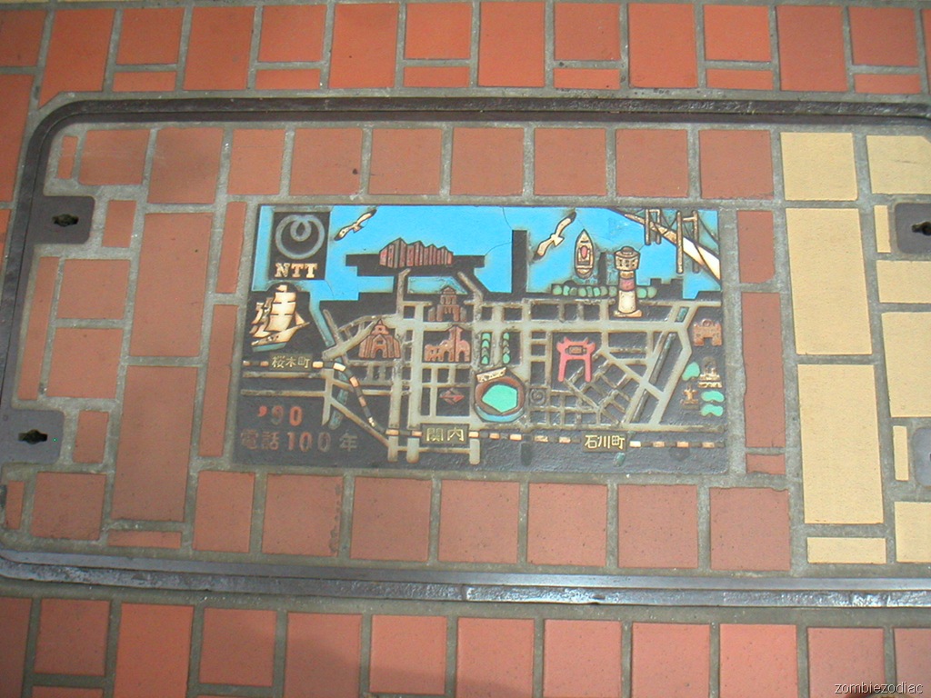 Another map found in Yokohama's Chinatown, this was placed on a utility cover by NTT, the phone company. It was done in celebration of 100 years of phone service, in 1990. It's not nearly detailed enough to be of use, but gives you an overall impression of the greater area and Yokohama's character.
